 |
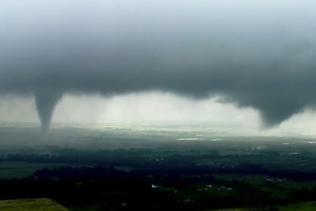
| Two funnel clouds in Crescent, Okla., on Monday. The Storm Prediction Center issued a tornado watch classifying the weather as a ‘particularly dangerous situation. |
Powerful storms could bring flooding, baseball-size hail, hurricane-force winds
By Erin Ailworth
Updated May 20, 2019 10:36 p.m. ET
Forecasters say a dangerous mix of warm air and fast, shifting winds is expected to spawn severe thunderstorms and violent tornadoes from the Texas panhandle into Oklahoma Monday evening and into Tuesday.
“The intensity of those ingredients is of a sort that we have rarely seen before,” said Bill Bunting, chief of forecast operations at National Oceanic and Atmospheric Administration’s Storm Prediction Center. “The atmosphere is not only unstable, it is extremely unstable.”
The Storm Prediction Center on Monday issued a tornado watch for the region classifying the weather as a “particularly dangerous situation.” Forecasters warned any tornadoes that touch down could travel dozens of miles.
The local National Weather Service in Norman, Okla., 20 miles south of Oklahoma City, was prepping for roughly baseball-size hail, hurricane-force winds and flash flooding. Forrest Mitchell, observations program leader, said he and his colleagues were also bracing for tornadoes rated near or at the top of the Enhanced Fujita scale.
“Anything it encounters will be destroyed,” Mr. Mitchell said, describing the destruction such a tornado could cause. “There’s an extreme threat to life and property.”
Late Monday, the National Weather Service in Norman said there had been several tornado warnings in Oklahoma and two confirmed tornadoes, one 60 miles north of Oklahoma City and one in southwest Oklahoma.
As the tornado threat continued, meteorologists cautioned that flooding was a major concern overnight, with several inches of rain expected to drop on already saturated parts of Oklahoma and Kansas.
“This rain is not going to help,” said Mr. Bunting, with the Storm Prediction Center. “I think at the end of this event, the flooding will be as impactful as the tornadoes.”
The dangerous weather, forecasters said, was caused by a combination of low pressure, warm humid air and shifting winds that increase in speed as they move higher. Tornadoes are often created when those shifting winds are strong at low altitudes—around 1,000 to 2,000 feet—and meet with pockets of warm, moist air.
Matt Lanza, managing editor with Space City Weather, a blog that tracks weather in Texas, said Monday’s forecast contained pointed language he has rarely seen from federal forecasters.
“Right away that tells me as someone who respects the [Storm Prediction Center] that they are deathly serious about this,” he said. “The atmosphere in parts of the Texas Panhandle and parts of southern Oklahoma, it’s a powder keg and it just needs a trigger to set it off.”
Write to Erin Ailworth at Erin.Ailworth@wsj.com
Appeared in the May 21, 2019, print edition as 'Oklahoma, Texas Brace for Storms.'
No comments:
Post a Comment
Note: Only a member of this blog may post a comment.